
Planning a trip to Vietnam's Central Highlands? Don't sleep on Kon Tum, a raw, hidden gem that completely bypasses the typical tourist crowds. This overlooked frontier offers the romantic, cool pine forests of Mang Den, totally uncommercialized Ba Na indigenous culture, and the legendary Indochina tri-border junction.
Kon Tum is renowned for its Central Highlands location, rich Ba Na indigenous culture, the unique East-to-West flowing Dak Bla River, historic 19th-century Catholic missions, and its strategic position near the Laos-Cambodia borders as a trading hub. Beyond these primary identifiers, the province operates as an essential intersection for regional commerce, linking highland agriculture with international supply chains.
.jpg)
The city itself offers a stark contrast to Vietnam’s coastal destinations. You will find wide, grid-like streets lined with mature trees and a noticeable absence of heavy tourist infrastructure. Instead, the area thrives on its agricultural output, primarily focusing on coffee, rubber, and high-value medicinal plants.
Historically, French missionaries established a strong presence here in the mid-19th century. Consequently, the local architecture and demographic makeup reflect a distinct blend of traditional animist beliefs and Catholicism. This unique cultural synthesis remains highly visible in the daily lives of the ethnic minority communities residing in villages immediately surrounding the city center.
.jpg)
Most river systems in Vietnam follow a predictable Northwest to Southeast trajectory, eventually emptying into the East Sea. The Dak Bla River defies this fundamental geographic norm, charting a course directly from East to West. It originates in the Ngoc Linh mountain range and flows toward the Se San River before crossing into Cambodia.
This distinct current creates unusual alluvial deposits along the riverbanks, supporting specialized local agriculture. The river acts as the geographic backbone of Kon Tum city, cutting directly through the municipal center. It provides a natural orientation point when you navigate the urban grid, while also functioning as a vital water source for provincial irrigation.
%20(1).jpg)
📌 Expert Insight:
Experience the Dak Bla river via a local sightseeing boat at sunset. It is famous for flowing East to West, contrary to most rivers in Vietnam. Booking a traditional wooden canoe ride near the main bridge offers an excellent perspective of this geographical anomaly while supporting local boatmen.
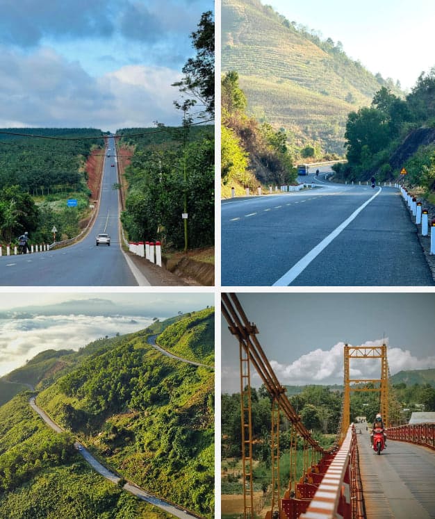
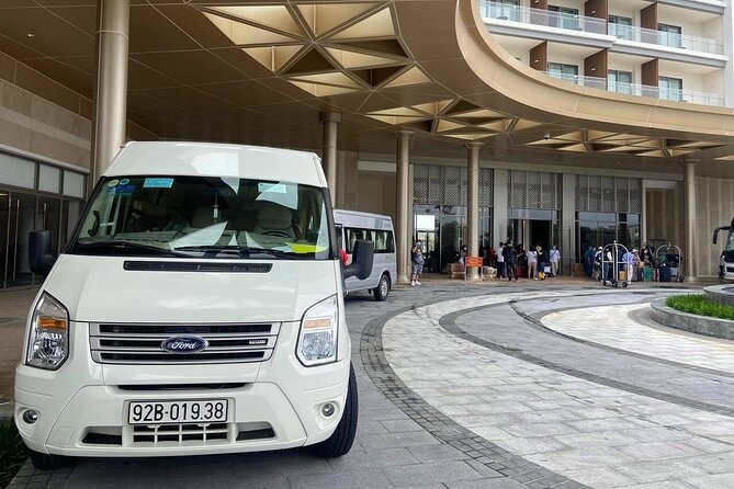
Kon Tum has no local airport, meaning travelers must fly into Pleiku (45km away) or Da Nang, then take a bus or taxi. Alternatively, a 10-12 hour sleeper bus runs directly from Ho Chi Minh City along National Highway 14. Securing transit requires minor advance planning, especially during major public holidays.
The absence of a direct flight connection effectively filters out mass tourism, preserving the region's raw character. Your choice of transport will depend largely on your budget, schedule flexibility, and tolerance for long-haul overland travel. Upgraded highway infrastructure has significantly reduced driving times compared to previous decades.
Pleiku Airport (PXU) serves as the primary aviation gateway for the northern Central Highlands. Domestic carriers like Vietnam Airlines, VietJet Air, and Bamboo Airways operate daily direct flights from Hanoi and Ho Chi Minh City. Flight durations average just over an hour.
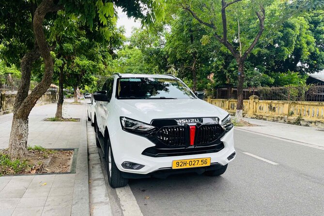
Upon landing at Pleiku Airport, you face a 45-kilometer overland transfer to reach Kon Tum city. The route follows National Highway 14 (QL14), a well-paved, multi-lane road. You can secure a ride directly from the arrivals terminal, but pre-booking guarantees better rates.
.jpg)
| Criteria | Private Taxi | Local Airport Shuttle / Bus |
|---|---|---|
| Transit Time | Approx 45 - 60 minutes | Approx 1.5 - 2 hours |
| Estimated Cost | 450,000 - 550,000 VND ($18-22) | 50,000 - 80,000 VND ($2-3) |
| Pros | Departs immediately, drops exactly at your hotel door. | Highly economical for solo travelers. |
| Cons | Most expensive option, requires negotiating if unmetered. | Fixed schedules, potential wait times, drops at main bus station only. |
If you prefer skipping the airport entirely, overnight sleeper buses provide a direct, albeit lengthy, connection from Ho Chi Minh City's Mien Dong Bus Station. The route covers 550 kilometers straight up National Highway 14. You can expect a 10-12 hour journey depending on weather and traffic conditions.
Modern operators deploy "VIP cabin" buses on this route. These vehicles feature individual pods with privacy curtains, massage functions, and USB charging ports. You should book lower-deck cabins if you suffer from motion sickness, as the highland roads feature frequent elevation changes.
.jpg)
Visit during the dry season from December to April for mild highland temperatures of 25-30°C, and avoid the May-November rainy period. The cooler months align perfectly with seasonal flora blooms across the province and in the elevated district of Mang Den. Traveling during the dry window significantly reduces the risk of landslides on mountain passes.
The Central Highlands experience distinct micro-climates based on elevation. While Kon Tum city averages around 500 meters above sea level and stays relatively warm, areas like Mang Den and Ngoc Linh sit much higher and require light winter clothing. The rainy season turns rural dirt roads into impassable mud, severely limiting your ability to visit remote ethnic villages.
.jpg)
Botanical tourism draws significant domestic crowds to the province. Because the blooming periods depend strictly on shifting weather patterns, timing your arrival to specific months yields excellent photography opportunities without dense crowds.
.jpg)
Key attractions include the 1913 Wooden Church, the Bishop's Palace museum, indigenous Ba Na longhouses, and the cool eco-resort town of Mang Den. The Indochina tri-border junction at Bo Y is also a major highlight. Visiting these dispersed sites effectively requires renting a motorcycle or hiring a private driver.
Unlike tightly clustered historic districts in other Vietnamese cities, Kon Tum’s points of interest spread across multiple districts. You should dedicate at least one full day to exploring the provincial capital's architectural sites, reserving subsequent days for overland excursions to the border or mountain resorts.
.jpg)
The Kon Tum Cathedral, universally known as The Wooden Church, stands as the city's architectural centerpiece. Constructed between 1913 and 1918, French priests and local artisans utilized Shorea roxburghii (Cà Chít wood) and traditional straw-mixed soil walls. The structure features no reinforced concrete or steel nails, relying entirely on complex timber joinery. It merges Romanesque basilica design with the soaring rooflines typical of Ba Na stilt houses.
.jpg)
A short distance away sits the Bishop's Palace (Toà Giám Mục), built in 1935. It stretches 100 meters long and features a highly polished wooden interior. Beyond its religious function, the building houses an "invisible" museum. This private collection preserves extremely rare ethnic artifacts, farming tools, and religious carvings gathered from minority groups over the past century. Note that the grounds are strictly closed to visitors on Tuesdays.
.jpg)
Located 50 kilometers northeast of the city via Highway 24, Mang Den serves as the region's high-altitude retreat. Sitting at 1,200 meters above sea level, it offers year-round cool weather and dense virgin pine forests. Many compare it to Da Lat before mass commercialization occurred.
| Criteria | Mang Den | Da Lat |
|---|---|---|
| Vibe | Quiet, raw eco-tourism, undeveloped | Highly commercialized, active nightlife |
| Elevation | 1,200 meters | 1,500 meters |
| Crowd Levels | Low, primarily domestic weekenders | Very high, heavy international traffic |
| Top Sights | Pa Sy Waterfall, Dak Ke Lake, Khanh Lam Pagoda | Xuan Huong Lake, Lang Biang, Crazy House |
.jpg)
📌 Expert Insight:
Mang Den is a hub for cold-weather agriculture. Try the local sturgeon raised in the icy mountain streams; its cartilage bones are entirely edible when cooked correctly and provide a unique crunchy texture distinct from traditional fish dishes.
For dedicated naturalists, Ngoc Linh Mountain demands attention. Reaching an elevation of 2,600 meters, it forms the highest peak in Central Vietnam. The area features extremely rugged terrain, heavy cloud cover, and strict access controls due to its proximity to sensitive border zones.
The mountain’s true significance lies in its soil. It is the exclusive home of Ngoc Linh Ginseng (Panax vietnamensis). Discovered in 1973, this root contains higher concentrations of saponin than Korean or American ginseng, making it one of the world's most potent and expensive varieties. A single kilogram can fetch upwards of several thousand US dollars, prompting tight security around the cultivation farms.
(1).jpg)
The Bo Y border gate connects Vietnam, Laos, and Cambodia, featuring a famous tri-border landmark on a 1,086m hill. Overland travelers cross here, but must prepare proper E-visa documentation and arrange international transport in advance. Accessing the actual border monument requires submitting your passport to border guards for temporary holding.
This remote junction appeals to overlanders navigating the "Ho Chi Minh Trail" routes or those transiting into southern Laos. The physical landmark allows you to stand with one foot in three different nations simultaneously. However, public transport to this precise point remains non-existent, requiring you to negotiate with taxi drivers in nearby towns.
The Bo Y Border Gate operates under strict regional schedules. The facility is open daily from 7:00 AM to 7:30 PM. You must account for meal breaks taken by border officials around noon, which can delay processing times by over an hour.
Geographically, the gate sits 75 kilometers northwest of Kon Tum city. The closest domestic hub is Plei Kan town, located 15 kilometers from the checkpoint. Most travelers sleep in Plei Kan the night before their crossing to ensure an early morning departure.
📌 Expert Insight:
The ultimate crossing guide: Vietnam E-visas are accepted at Bo Y, but your document must explicitly state "Bo Y Landport" as your entry/exit point. For Laos, daily buses run from Kon Tum city to Attapeu province, costing approximately $15 USD. The journey takes 4-5 hours, excluding border stamp processing time.
Kon Tum is generally very safe for tourists with stable security. Standard precautions for remote highlands apply. It is crucial to respect ethnic customs, use registered transport, and follow specific protocols when visiting indigenous Ba Na villages. Petty crime rates are exceptionally low compared to coastal tourist hubs.
You should prioritize medical preparedness. Hospitals in the provincial capital provide adequate care for minor ailments, but serious injuries require evacuation to Da Nang or Ho Chi Minh City. Furthermore, specific highland insects transmit diseases like dengue fever during the wet season, making heavy-duty repellent mandatory for rural excursions.
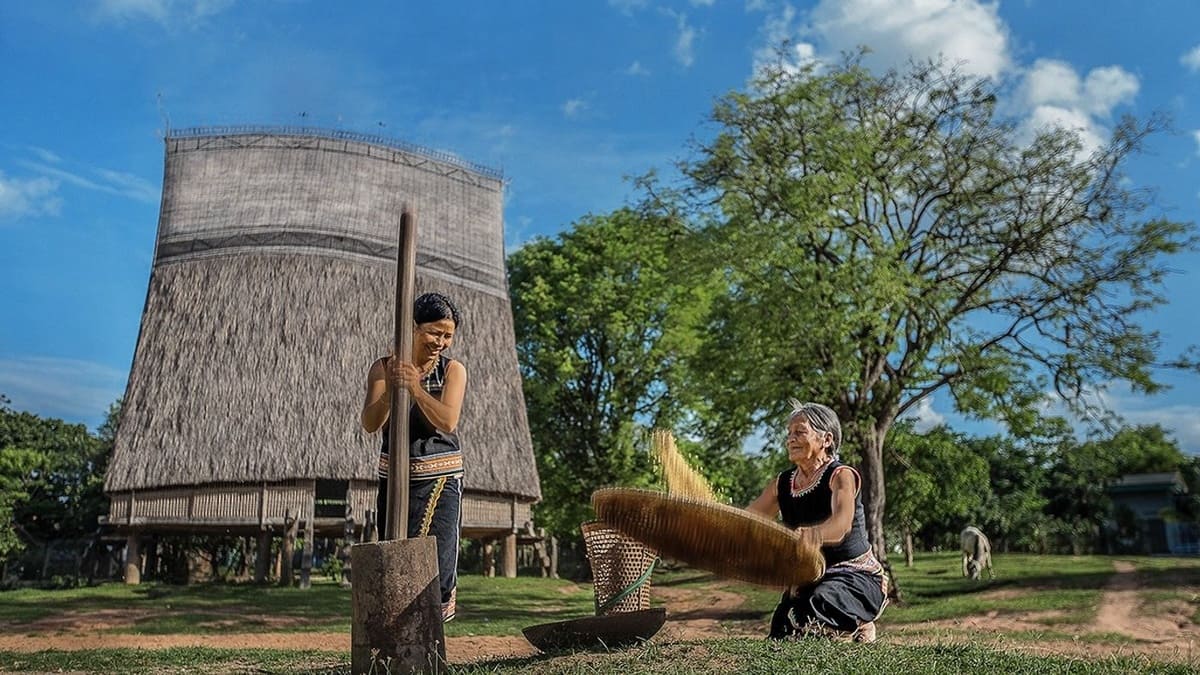
(1).jpg)
The Ba Na people maintain strict behavioral codes regarding their communal spaces. The towering Nhà Rông (communal house) functions as the spiritual and political center of the village. You must always remove your shoes before stepping onto the bamboo flooring, just as you would inside a private home.
Photography requires active consent. Always ask for clear permission before photographing village elders, daily labor activities, or spiritual totems. During village festivals, locals may invite you to drink Rượu Cần (traditional tube wine fermented in ceramic jars). You must accept the bamboo straw with both hands. If you cannot drink, politely touch the jar and gesture respectfully to decline, rather than simply walking away.
.jpg)
📌 Expert Insight:
Practice sustainable tourism by buying local hill tribe crafts, such as hand-woven brocade textiles, instead of gifting candy or money to children. This direct economic support fosters a healthier tourism ecosystem and discourages youth truancy.
Highland cuisine utilizes heavy forest foraging, resulting in flavor profiles vastly different from standard Vietnamese fare. The most famous regional specialty is the Leaf Salad (Gỏi Lá). True Kon Tum leaf salad must contain an exact 40 to 100 different types of leaves; anything under 40 is considered an incomplete imitation. You wrap boiled pork belly, roasted shrimp, and peppercorns in a funnel made from mustard greens, guava leaves, and sour starfruit leaves, then fill it with a rich dipping sauce made from fermented rice and pork liver.
.jpg)
For more adventurous eaters, the region offers Weaver Ant Salad (Gỏi Kiến Vàng). Found primarily in Sa Thay district, the Ro Mam minority group harvests yellow weaver ants from high fruit trees. They gently roast the ants to retain a unique acidic pop, then mix them with local herbs, chili, and wild banana trunk. This high-protein dish provides a sharp, citrus-like flavor that pairs excellently with cold local beer.
CTA TA
Best visited during dry season (November to April) for ideal weather.
Book accommodations in advance during peak travel season.
Carry local currency (Vietnamese Dong) for markets and small vendors.
Respect local customs and dress modestly when visiting temples.


Hanoi, Vietnam
Walk past the immigration queue at Noi Bai Airport. A dedicated Sondax escort guides you through priority lanes — typically done in under 20 minutes.
Ho Chi Minh City, Vietnam
Beat the immigration queue at Tan Son Nhat Airport. Our team escorts you through priority lanes — arrival or departure done in under 30 minutes.
Nha Trang, Vietnam
Priority immigration clearance at Cam Ranh International Airport. Quick entry to Nha Trang.
Da Nang, Vietnam
Priority immigration clearance at Da Nang International Airport. Skip the queue and clear immigration quickly.

Phu Quoc, Vietnam
Priority immigration clearance at Phu Quoc International Airport. Fast entry to paradise island.